Showing posts with label Earth. Show all posts
[PHOTOGRAPHY] Looking down at storms from above

[PHOTOGRAPHY] Looking down at storms from above

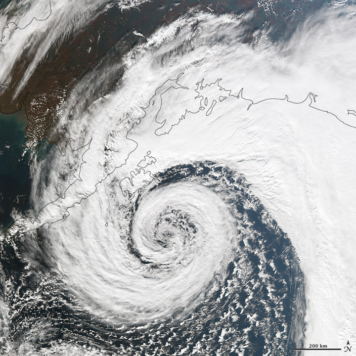
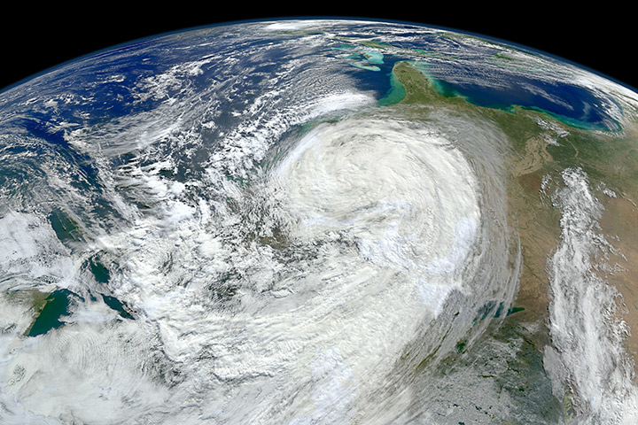
Heavy storm approaching the southern coast of Alaska on September 26, 2012.
You can find more photos of storms, typhoons and hurricanes from the above on NASA's Earth Observatory site here . These photos are possible thanks to Sumoi NPP, a partnership between NASA, the National Oceanic and Atmospheric Administration and the Department of Defense.


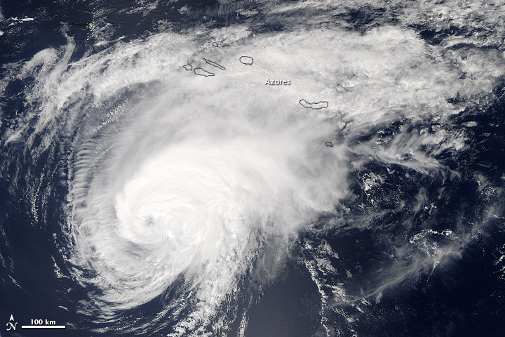
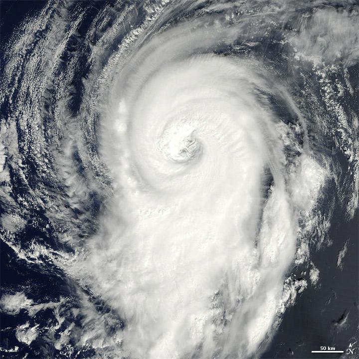
Hurricane Gordon over the Atlantic Ocean on August 19, 2012
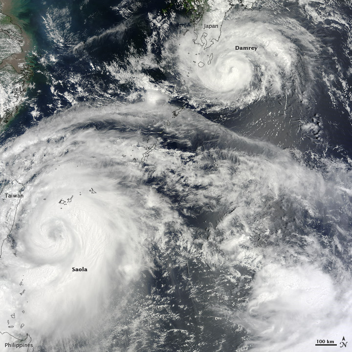
Typhoons Saola and Damrey  over the western Pacific Ocean in August 2012
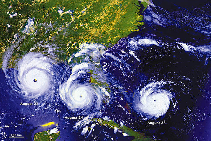
Hurricane Andrew struck on August 23 as a Category 3 hurricane causing $26.5 billion in damages - August 24, 1992
Hurricane Michael had wind speeds of 90 miles/150 kilometers per hour on September 9 2012
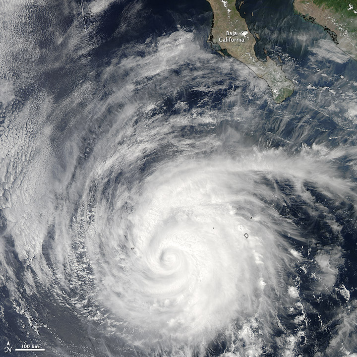
Miriam began forming September 22, 2012, only as as a tropical depression over the eastern Pacific Ocean, but two days later it turned into a Category 3 hurricane
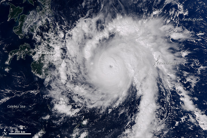
Typhoon Bopha moving towards Philippines December 3 2012. It packed winds of 260 kilometers per hour and gusts up to 315 kilometers per hour.


[PHOTOGRAPHY] Pictures from NASA of the Earth's atmosphere and a treat

dust plumes off the coasts of Iran and Pakistan, November 29, 2012 - NASA images


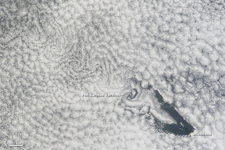
NASA published this image of cloud vortices above the southern Atlantic Ocean Island of St. Helena- November 15, 2012
Hurricane Sandy ravaged the East Coast and using the Suomi NPP satellite and Visible Infrared Imaging Radiometer Suite, NASA caught a glimpse of the sediments the storm brought up from the continental shelf.
Eye of the storm approaching the southern coast of Alaska on September 26, 2012.
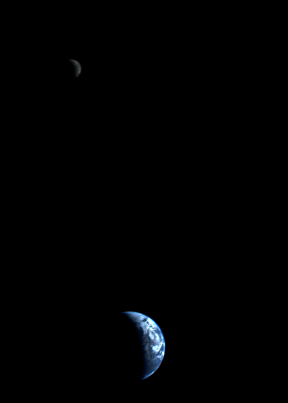
Image taken by NASA's Voyager 1 spacecraft, which has been traveling in outer space for the past 35 years. Image was taken by Imaging Science Subsystem on Voyager 1 when the spacecraft was closest to the Earth:September 18, 1977